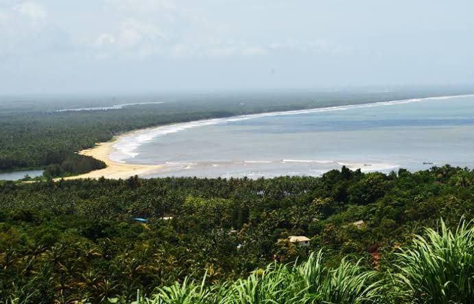
Kolattunādu (Kola Swarupam, as Kingdom of Cannanore in foreign accounts, Chirakkal (Chericul) in later times) was one of the four most powerful kingdoms on the Malabar Coast during the arrival of the Portuguese Armadas in India, along with Zamorin, the Kingdom of Cochin and Quilon. Kolattunādu had its capital at Ezhimala and was ruled by the Kolattiri royal family and roughly comprised the North Malabar region of Kerala state in India. Traditionally, Kolattunādu is described as the land lying between the Chandragiri river in the north and the Korappuzha river in the south. The Kolathunadu (Kannur) Kingdom at the peak of its power, reportedly extended from the Netravati River (Mangalore) in the north to Korapuzha (Kozhikode) in the south with the Arabian Sea on the west and Kodagu hills on the eastern boundary, also including the isolated islands of Lakshadweep in the Arabian Sea.
━━━━━━━━━━━━━
🏝 @ | @ 🥥
Читать полностью…
Varayadumotta is the tallest peak in the Ponmudi mountain range (Western ghats), Nedumangad taluk, Thiruvananthapuram, Kerala, India. As its name come from Nilgiri tahr/ Varayadu. It is one of the isolated place which is favourable home for mountain goats (Nilgiri Tahr) in acute population. These mountain range is also known as Varayadumudi and Varayattumutti.
It stands about a height of about 1100 m. Varying elevation and peculiar shape of these hill is unique in the world. It is a protected mountain ridge situated in between Ponmudi hills, Palode (Brimore) hills and Kallar valley. It includes 13 peaks and the second peak is the highest peak in Varayadumotta. It is the third adventurous trekking in South India after Meesapulimala and Agastyarkoodam.
Popular tourist spots near Varayadumotta peak include Kallar river, Ponmudi, Meenmutty waterfalls, Manakayam waterfalls and Brimore estate. It is 40 km away from Thiruvananthapuram city.
━━━━━━━━━━━━━
🏝 @ | @ 🥥
Читать полностью…
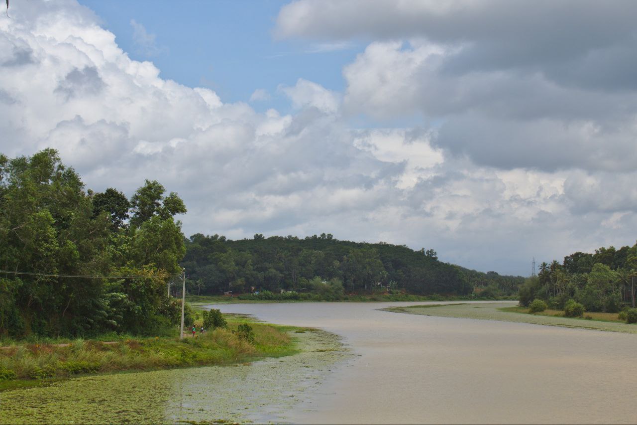
Vamanapuram River is an 88 km (55 mi) long river in southern Kerala that flows through the northern parts of Thiruvananthapuram district. It is also the longest river in Thiruvananthapuram district. The river is also known as "Kollampuzhayaru" and "Attingalaru". The two tributaries of this river are the Upper Chittar & Manjaprayaar streams which originates near Ponmudi hill station.
━━━━━━━━━━━━━
🏝 @ | @ 🥥
Читать полностью…
Aryanadu is a village town in Thiruvananthapuram district, Kerala, India, lying under the foothills of the Agastyarkoodam of the Sahya mountains. The village is spread along the sides of Karamana River in the western ghats of Agasthya Mountains. The Aryanad Panchayath has border with Uzhamalakkal, Vellanad, Poovachal, Kuttichal, Vithura, Tholickode panchayaths. Aryanad is residing Nedumangad Taluk and Aruvikkara Legislative Assembly. It is situated around 25 km from Thiruvananthapuram. G. Steephen is the current sitting MLA of Aryanad (Aruvikkara Constituency).
━━━━━━━━━━━━━
🏝 @ | @ 🥥
Читать полностью…
Karamana is a river flowing through the city of Thiruvananthapuram in Kerala, India. The river starts near the southern tip of the Western Ghats (Sahyadri Mountains) at Agastyar Koodam. The river flows 66 km westward and merges with the Arabian Sea at Panathura near Kovalam. The river gets its name from Karamana, a suburb of Thiruvananthapuram city, through which it flows.
The catchment area is mostly forested, the command area is under mixed dry land crops such as coconut, tapioca, pepper, plantain, rice, etc.
━━━━━━━━━━━━━
🏝 @ | @ 🥥
Читать полностью…
The Agasthyamala Biosphere Reserve is a biosphere reserve in India established in 2001, located in the southernmost end of the Western Ghats and includes 3,500.36 km² (1,351.50 sq mi) of which 1828 km² is in Kerala and 1672.36 km² is in Tamil Nadu. It encompasses the following wildlife sanctuaries: Shendurney Wildlife Sanctuary, Peppara Wildlife Sanctuary, Neyyar Wildlife Sanctuary, and Kalakkad Mundanthurai Tiger Reserve.
Agasthyamalai Biosphere Reserve became part of the UNESCO World Network of Biosphere Reserves in 2016.
━━━━━━━━━━━━━
🏝 @ | @ 🥥
Читать полностью…
Aryankavu is a village located in the Kollam district of the Indian state of Kerala. It lies close to the border between Kerala and Tamil Nadu near Thenmala. It is also one of the famous pilgrimage sites associated with the legend of Sabarimala. The village is located beside Shendurney Wildlife Sanctuary.
━━━━━━━━━━━━━
🏝 @ | @ 🥥
Читать полностью…
The International Synthetic Turf Hockey Stadium is a hockey stadium situated at the city of Kollam, first of its kind in Kerala state, with a nominal capacity of around seats.
The stadium is located in an area which was formerly known as Depot Maidan within the Asramam Government property complex, less than 700 meters from the Chinnakada traffic circle. The Depot Maidan lies on the way to the Yatri Nivas Hotel from Chinnakada and was serving as a timber depot of the Forest Department before.
The International Hockey Stadium in Kollam can host international hockey matches along the likes of New Delhi, Bangalore, Patiala and Ranchi. The stadium has picturesque surroundings with Ashtamudi Lake amidst much greenery. National Games Secretariat was overseeing the works of the stadium as part of National Games-2015.
━━━━━━━━━━━━━
🏝 @ | @ 🥥
Читать полностью…
Kumbalam is a picturesque region in Kochi, in the state of Kerala, India. A water-bound countryside, bound by the Vembanad Lake, as well as the fast-encroaching city of Kochi, it is situated around 9 km from Vytilla Junction.
Kumbalam is surrounded by Thevara in North, Wellington Island in North West, Edakochi in West, Kumbalangi in South West, Aroor in South, Panangad in Eastern side, Nettoor in North Eastern side.
━━━━━━━━━━━━━
🏝 @ | @ 🥥
Читать полностью…
Kundannoor is a region in the city of Kochi, in the state of Kerala, India. It is located around 3.5 km from Vytilla Junction and around 7 km from Ernakulam Junction Railway Station. Kundanoor is located on the busiest road of the city and state, the Kochi Bypass, at the junction of three National Highways, namely NH 66, NH 85 and NH 966B. NH 966B is the second shortest National highway in India.
The junction now has a six-lane flyover due to the high traffic it handles. Since the current Kochi Bypass carries over twice the traffic it is designed to handle, the National Highways Authority of India had come up with a proposal for a new bypass for Kochi city a few years ago. As per the selected alignment, the Kochi New Bypass will begin from NH 544 at Karayamparambu, north of Kochi's suburb Angamaly, and end at NH 66 at Nettoor region of Maradu.
In addition to this new greenfield National Highway project, the existing NH 85 (Kochi-Dhanushkodi) starting from Kundannoor junction will be widened to a four-lane one under Bharatmala. As per the plans the new widened NH will avoid the current NH 85 until Puthenkurishu, starting around 1 kilometre south of the existing Kundanoor Junction.
━━━━━━━━━━━━━
🏝 @ | @ 🥥
Читать полностью…
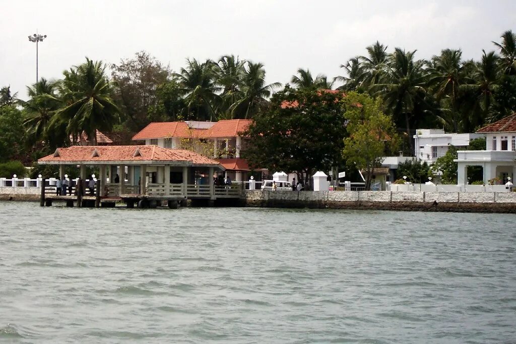
Willingdon Island is the largest artificial island in India, which forms part of the city of Kochi, in the state of Kerala. Much of the present Willingdon Island was claimed from the Lake of Kochi, filling in dredged soil around a previously existing, but tiny, natural island. Willingdon Island is significant as the home for the Port of Kochi as well as the Kochi Naval Base, the Southern Naval Command of the Indian Navy, Plant Quarantine station, Custom House Cochin and Central Institute of Fisheries Technology, a constituent unit of Indian Council of Agricultural Research.
The island is also home for other establishments associated with the port, namely, the Office of the Cochin Port Trust (that controls the Port of Kochi), the Customs Office, the Mercantile Marine Department and more than two dozen export-import offices, warehouses, a few hotels and business centers. The Cochin Port Maritime Heritage Museum is located on the island.
━━━━━━━━━━━━━
🏝 @ | @ 🥥
Читать полностью…
Kerala
29 апреля 2023 06:45
Attingal is a municipality in Thiruvananthapuram metropolitan area in Thiruvananthapuram district of Kerala state, India. It was the location of the Attingal kingdom, under Travancore. It is the headquarters of Chirayinkeezhu Taluk, and the important government institutions of the taluk such as the Taluk office, court complex, office of the deputy superintendent of Police, civil station, and treasuries are situated in Attingal. It is one of the oldest municipalities of Kerala which was constituted prior to its independence in 1924. In 1914 itself Attingal Town Improvement Authority (TIA) was formed which was the term used before the municipality regulation act of 1922. Attingal Town is located 25 kilometres (16 mi) north of Thiruvananthapuram. Attingal is the 3rd densely populated municipality in the district.
━━━━━━━━━━━━━
🏝 @ | @ 🥥
Читать полностью…
Kerala
27 апреля 2023 06:00
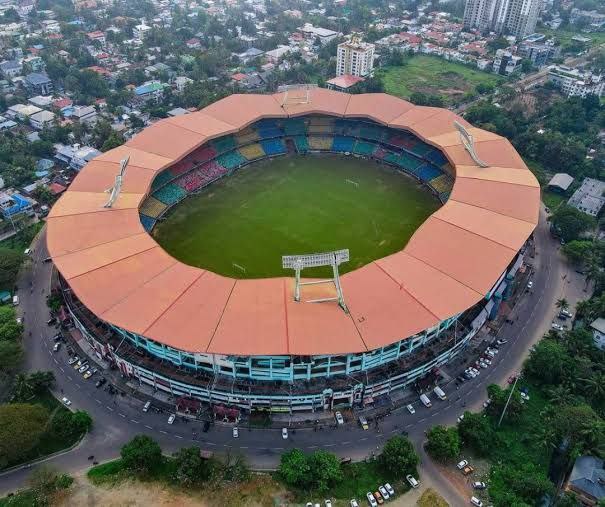
The stadium at The Sports Hub, Trivandrum is officially named Greenfield International Stadium. It was known as Trivandrum International Stadium. The stadium is a multi-purpose stadium in Kerala, used mainly for cricket. The stadium is located at Kariavattom in Thiruvananthapuram city, Kerala, India. It was built on 36 acres of land leased by the Kerala University for ₹94 lakh (US$146,527.23) per year for a period of 15 years. It is India's first DBOT (design, build, operate and transfer) model outdoor stadium. The Greenfield Stadium became India's 50th international cricket venue on 7 November 2017 when it hosted a T20I against New Zealand. On 1 November 2018, the venue hosted its first ODI. The Greenfield International Stadium is the main venue for the Kerala cricket team.
━━━━━━━━━━━━━
🏝 @ | @ 🥥
Читать полностью…
Kerala
24 апреля 2023 05:53
Palakkad railway division (formerly Olavakkod railway division) is one of the six administrative divisions of the Southern Railway zone of Indian Railways. It is headquartered in the city of Palakkad, Kerala. It is the smallest railway division in the Southern Railway. It was formed by dissolving the Podanur division. Managing 588 route kilometers of track in the states of Kerala, Tamil Nadu, Karnataka and Mahé (in the Union Territory of Puducherry), it is one of the oldest railway divisions in India and had a route connectivity of nearly 1,247 km before the formation of current Thiruvananthapuram and Salem divisions. Major stations under the railway division are Palakkad Junction, Shoranur Junction, Kuttippuram, Tirur, Kozhikode, Vatakara, Thalassery, Kannur, Payyanur, Kanhangad, Kasaragod, Mangalore Central, Mangalore Junction and Pollachi Junction. The terminal facility of Palakkad division is situated in Shoranur Junction & Mangalore Central of Karnataka state.
━━━━━━━━━━━━━
🏝 @ | @ 🥥
Читать полностью…
Kerala
22 апреля 2023 09:35
Bharathappuzha ("River of Bhārata"), also known as the Nila or Ponnani River, is a river in India in the state of Kerala. With a length of 209 km, it is the second longest river that flows through Kerala after the Periyar. It flows through Palakkad Gap, which is also the largest opening in the Kerala portion of Western Ghats. Nila has groomed the culture and life of South Malabar part of Kerala. It is also referred to as "Peraar" in ancient scripts and documents. River Bharathapuzha is an interstate river and lifeline water source for a population residing in four administrative districts, namely Malappuram and Palakkad districts, and parts of Palakkad-Thrissur district border of Kerala and Coimbatore, and Tiruppur of Tamil Nadu. The fertile Thrissur-Ponnani Kole Wetlands lie on its bank.
━━━━━━━━━━━━━
🏝 @ | @ 🥥
Читать полностью…
Kerala Science and Technology Museum is an autonomous institution established by Government of Kerala, India, in 1984, as a center for popularisation of science and scientific temper among the general public, especially among the young generation. The institution is in the heart of Thiruvananthapuram city, in Kerala. The Priyadarsini Planetarium is attached to the museum, functioning since 1994.
━━━━━━━━━━━━━
🏝 @ | @ 🥥
Читать полностью…
Kallar is the upper tributary of Vamanapuram River flowing through the Indian state of Kerala. The river originates in the Chemunjimotta hills (alt. 1860 m) hills on the southern side of the Western Ghats, and flows entirely through Thiruvananthapuram district of Kerala. The Meenmutty Falls and Lower Meenmutty dam are situated in this river.
━━━━━━━━━━━━━
🏝 @ | @ 🥥
Читать полностью…
Vithura, also known as the Hill City Of Trivandrum, is located 36 km from Thiruvananthapuram capital of the Kerala state in India. Vithura is the culmination of the crossroads to many tourist, cultural, and religious centres. Surrounded by the Western Ghats (Sahyadris), Vithura is a prime tourist spot. The village is rich with a very scenic beauty and a good climate year-round. The Indian Institute of Science Education and Research, Thiruvananthapuram campus, one of the leading public science universities in the country, is situated here.
━━━━━━━━━━━━━
🏝 @ | @ 🥥
Читать полностью…
Karamana is a river flowing through the city of Thiruvananthapuram in Kerala, India. The river starts near the southern tip of the Western Ghats (Sahyadri Mountains) at Agastyar Koodam. The river flows 66 km westward and merges with the Arabian Sea at Panathura near Kovalam. The river gets its name from Karamana, a suburb of Thiruvananthapuram city, through which it flows.
The catchment area is mostly forested, the command area is under mixed dry land crops such as coconut, tapioca, pepper, plantain, rice, etc.
━━━━━━━━━━━━━
🏝 @ | @ 🥥
Читать полностью…
Peppara Dam is a masonry gravity dam on the Karamana River in Trivandrum District. It was built by the Kerala Water Authority in 1983 has a catchment area of 83 km² and receives an average rain fall of 481 cm. The 423 m long dam unifies all upper tributaries of the Karamana river and water flow to Aruvikkara is regulated to suit the needs of the Trivandrum city. There is also a 3MW hydel power station at Peppara. It is the main drinking water supply to Thiruvananthapuram city and suburban areas. This dam is situated inside the Peppara Wildlife Sanctuary.
━━━━━━━━━━━━━
🏝 @ | @ 🥥
Читать полностью…
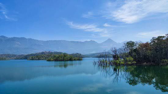
Shendurney Wildlife Sanctuary is a protected area in the Western Ghats, India, located in Kollam district of Kerala and comes under the control of the Agasthyamalai Biosphere Reserve. It was established on 25 August 1984 and comprises 172.403 square kilometres (66.565 sq mi). The name is a corruption of the Chengurinji, a tree endemic to the region (Gluta travancorica). The sanctuary has an artificial lake of nearly 18.69 square km size and is also surrounded by the reservoir of Thenmala Dam. The Shendurney Wildlife Sanctuary is a treasure house of plant diversity. About 1257 species of flowering plants belonging to more than 150 families are reported from this sanctuary of which 309 species are endemic to Western Ghats. Birds from 267 species including migratory, endemic and endangered species have been reported here.
━━━━━━━━━━━━━
🏝 @ | @ 🥥
Читать полностью…
Thenmala is a tourist destination in the eastern side of Kollam district in Kerala, India that is home to the first eco-tourism centre in India. The word 'Thenmala' means "Southern hill" in Malayalam language. The town is 66 km away from Kollam city, 69 km from the state capital Trivandrum and is just 14 km away from Tamil Nadu state border. The interstate National Highway-744, connecting Kollam with Madurai in Tamil Nadu, and State Highway-2 of Kerala are passing through Thenmala.
━━━━━━━━━━━━━
🏝 @ | @ 🥥
Читать полностью…
Aroor is a census town at the northern end of Alappuzha district and the southern suburb of the city of Kochi in the state of Kerala, India. It is a seafood related industrial area of Alleppey district, and acts as the Southern entry point into Kochi city.
Aroor is at present a gramapanchayath located just south of Kochi Urban Agglomeration. It is expected to be a part of Kochi UA in the upcoming census, since its urban growth is now continuous with Kochi city.
━━━━━━━━━━━━━
🏝 @ | @ 🥥
Читать полностью…
The Kochi Bypass is a segment of NH66 (National Highway 66) that bypasses the CBD of the city of Kochi in Kerala, India. The highway stretches 17 km from Edapally in the Ernakulam district to Aroor in Alappuzha district , via. Palarivattom, Vyttila, Kundannoor, Madavana, Kumbalam. The Government of Kerala began the preliminary works in 1973. After slow progress, it was partially opened for traffic in the beginning years of the 1980s. The section between Edapally and Vyttila had four lanes from the beginning. The rest of the carriageway was also upgraded to different sections of 4 lanes, 5 lanes and 6 lanes by 2010.
━━━━━━━━━━━━━
🏝 @ | @ 🥥
Читать полностью…
Maradu is a fast developing region in the city of Kochi in Kerala, India. It is located about 7 km (4.3 mi) from the city center. It was formed in May 1953 as a Grama Panchayath and was upgraded to the level of municipality in November 2010. National highways NH 85, NH 966 B and NH 66 pass through Maradu and have played a vital role in the development of the area. Maradu is well connected by waterways as well. Maradu is known for the famous "Maradu Vedikkettu" in Maradu Temple.
━━━━━━━━━━━━━
🏝 @ | @ 🥥
Читать полностью…
Kerala
30 апреля 2023 04:22
The Jawaharlal Nehru International Stadium, also known as Kaloor Stadium, is a multi-purpose stadium in Kochi, Kerala, India. The stadium has a capacity of 80,000 spectators but is reduced to 41,000 for Indian Super League matches due to various security reasons. It is the home ground of the Indian Super League Club Kerala Blasters FC. The stadium is widely touted to have hosted one of the loudest audiences for association football matches in the world.
The stadium has played host to a number of international cricket and football matches but after 2014 it didn't hold any cricket match due to ISL. The extensive grounds of the stadium serve as venue for important exhibitions, cinema events and political rallies in the city. The most innovative aspect of the stadium is its unique lighting towers of 2 kW Floodlights which when switched on fully can provide lighting levels for HD telecast. The Structure of the tower is itself one of a kind in India. Greater Cochin Development Authority leased out the Jawaharlal Nehru International stadium at Kaloor to the Kerala Cricket Association (KCA) for a period of 30 years.
━━━━━━━━━━━━━
🏝 @ | @ 🥥
Читать полностью…
Kerala
28 апреля 2023 07:11
Nedumangad is a town and municipality in Thiruvananthapuram metropolitan area of Thiruvananthapuram district in the Indian state of Kerala, and is the headquarters of Nedumangad tehsil and Nedumangad Revenue Division (RDO). It is a suburb of the extended metropolitan region of Thiruvananthapuram city. It is located around 16 km to the north-east of Thiruvananthapuram city on the Thiruvananthapuram – Shenkottah (State Highway 2). It is an important commercial center in the district. It is a growing commercial and educational hub and all important government institutions are situated in the town. Nedumangadu Market is important in South Kerala.
━━━━━━━━━━━━━
🏝 @ | @ 🥥
Читать полностью…
Kerala
25 апреля 2023 03:56
The Anamala or Anaimalai, also known as the Elephant Mountains, are a range of mountains in the southern Western Ghats of central Kerala (Idukki district, Ernakulam district, Palakkad district, Thrissur district) and span the border of western Tamil Nadu (Coimbatore district and Tiruppur district) in Southern India. The name anamala is derived from the Malayalam word aana and the Tamil word aanai, meaning elephant, or from tribal languages. Mala or Malai means 'hill', and thus 'Elephant hill.
━━━━━━━━━━━━━
🏝 @ | @ 🥥
Читать полностью…
Kerala
23 апреля 2023 05:19
Palakkad Gap or Palghat Gap is a low mountain pass in the Western Ghats between Coimbatore in Tamil Nadu and Palakkad in Kerala. It has an average elevation of 140 metres (460 ft) with a width of 24–30 kilometres (15–19 mi). The pass is located between the Nilgiri Hills to the north and Anaimalai Hills to the south.
There are various theories about the origin of Palakkad gap. One among them is that it is caused by the landslide due to rivers flowing in opposite directions. The Bharathappuzha river (River Ponnani) originates in the Palakkad Gap from rivulets and tributaries feeding from steep escarpment slopes along the flanks of the Ghats. Another theory suggests that the gap may be created by an asteroid strike around 800 million to 550 million years ago.
The Palakkad gap has played a major role in enabling human migration into Kerala from parts of Tamil Nadu. From 300 B.C. to 13th century, it also helped the Cheras rule the entire Kerala and the Kongu Nadu as one geographical unit from Karur in Western Tamil Nadu. Tamil Brahmins migrated to Palakkad from Central Tamil Nadu via the Palakkad gap from the 15th century to 18th century.
━━━━━━━━━━━━━
🏝 @ | @ 🥥
Читать полностью…
Kerala
21 апреля 2023 07:05
Ottapalam, (also spelled Ottappalam) is a town, taluk and municipality in the Palakkad District, Kerala, India. It is the administrative headquarters of the Ottapalam taluk. Ottapalam is located about 36 km from district headquarters Palakkad. Ottapalam is located along the banks of Bharathapuzha, second longest river of the state.
It is one of the major commercial centres in the district. Ottapalam was raised as a municipality in 1934, making it one of the municipalities that were formed before Indian independence and third oldest municipality in the district after Palakkad and Chittur-Thathamangalam. It is one of the major filming locations in Kerala.
━━━━━━━━━━━━━
🏝 @ | @ 🥥
Читать полностью…


 10192
10192