Kerala
17 января 2023 03:24
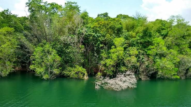
Vynthala is a very old village by the banks of Chalakudy River and 10 km from Chalakudy town in Thrissur district, state of Kerala, India. It is an old farming community and the main crop was rice. Other crops cultivated include: coconut trees and nutmeg. The main industry was the manufacture of roofing clay tiles by several companies engaged in that business. There is one high school (St. Mary's) and a Christian church (St. Joseph). At present both cultivation of rice and clay tile works are declining.
━━━━━━━━━━━━━
🏝 @ | @ 🥥
Читать полностью…
Kerala
15 января 2023 03:39
Sasthamcotta Lake or Sasthamkotta Lake, also categorized as a wetland, is the largest fresh water lake in Kerala, a state of India on the south of the West Coast. The lake is named after the ancient Sastha temple (a pilgrimage centre) located on its bank. It meets the drinking water needs of half million people of the Quilon district and also provides fishing resources. The purity of the lake water for drinking use is attributed to the presence of a large population of larva called cavaborus that consumes bacteria in the lake water. The lake has been a designated wetland of international importance under the Ramsar Convention since November 2002.
━━━━━━━━━━━━━
🏝 @ | @ 🥥
Читать полностью…
Kerala
13 января 2023 03:37
Paravur Kayal is a lake in Paravur, Kollam district, Kerala, India. Although it is small, with an area of only 6.62 km², it is the end point of the Ithikkara River and part of the system of lakes and canals that make up the Kerala Backwaters. It has been connected to Edava and Ashtamudi Kayal as part of the Trivandrum - Shoranur canal system since the late 19th century.
━━━━━━━━━━━━━
🏝 @ | @ 🥥
Читать полностью…
Kerala
11 января 2023 03:19
Appam is a type of thin pancake originating from Kerala. It is made with fermented rice batter and coconut milk, traditionally cooked in an appachatti, a deep pan similar in shape to a wok. It is common in the cusine of Kerala and Tamil Nadu. Appam are most frequently served for breakfast or dinner, often with a topping such as an egg.
━━━━━━━━━━━━━
🏝 @ | @ 🥥
Читать полностью…
Kerala
09 января 2023 06:06
Idamalayar Dam is a multipurpose concrete gravity dam located at Ennakkal between Ayyampuzha and Bhoothathankettu in Ernakulam district of Kerala on the Idamalayar, a tributary of the Periyar River in Kerala, South India. The dam however extends east as far as Malakkappara. Completed in 1985, with a length of 373 metres (1,224 ft) and a height of 102.8 metres (337 ft), the dam created a multipurpose reservoir covering 28.3 km² (10.9 sq mi) in the scenic hills of the Anamalais.
━━━━━━━━━━━━━
🏝 @ | @ 🥥
Читать полностью…
Kerala
07 января 2023 03:17
Silent Valley National Park is a national park in Kerala, India. It is located in the Nilgiri hills, has a core area of 89.52 km² (34.56 sq mi), which is surrounded by a buffer zone of 148 km² (57 sq mi). This national park has some rare species of flora and fauna. This area was explored in 1847 by the botanist Robert Wight. It is located in the border of Mannarkkad Taluk of Palakkad district, Nilambur Taluk of Malappuram district, Kerala, and Nilgiris district of Tamil Nadu.
━━━━━━━━━━━━━
🏝 @ | @ 🥥
Читать полностью…
Kerala
05 января 2023 03:04
Marayur or Marayoor is a town in Devikulam taluk of Idukki district in Kerala, India. It is located 42 kilometers north of Munnar on SH 17 connecting Munnar with Udumalpet, Tamil Nadu. Marayur is situated at around 1,600 metres (5,200 ft) above mean sea level and is the only place in Kerala that has natural sandalwood forests. Ancient dolmens and rock paintings in Marayur date back to the Stone Age. In 1991 Marayur had a population of 9,590.
━━━━━━━━━━━━━
🏝 @ | @ 🥥
Читать полностью…
Kerala
03 января 2023 04:11
Chimmini Dam is situated in Echippara in Chalakudy taluk of Thrissur District of Kerala state of India. It is constructed across the Kurumali river, a tributary of the Karuvannur river. Chimmini is the largest dam of Thrissur district. The Chimminy Wild Life Sanctuary is located close to the dam. Construction of the 495-metre masonry and 686-metre earthen dam started in 1975 and it was completed in 1996. The total cost of the project was Rs 59.71 crore although the cost of construction of the dam was initially estimated at Rs 36.15 crore.
━━━━━━━━━━━━━
🏝 @ | @ 🥥
Читать полностью…
Kerala
01 января 2023 04:44
The Peppara Wildlife Sanctuary is a wildlife sanctuary in Thiruvananthapuram district of Kerala, India. It consists of the catchment area of the Karamana River, which originates from Chemmunjimottai, the tallest hill within the sanctuary. The sanctuary is named after the Peppara Dam, commissioned in 1983 to augment the drinking water supply to Thiruvananthapuram city and suburban areas. Considering the ecological significance of the area, it was declared a sanctuary in 1983. The terrain is undulating with elevation ranging from 100 m to 1717 m. The area of the sanctuary is 75 km² with tropical moist evergreen forests and myristica swamps. It is part of the Agasthyamala Biosphere Reserve. Peppara Wildlife Sanctuary is 44 kilometres (27 mi) by car from the nearest railway station, at Thiruvananthapuram, and 49 kilometres (30 mi) from the Thiruvananthapuram airport.
━━━━━━━━━━━━━
🏝 @ | @ 🥥
Читать полностью…
Kerala
30 декабря 2022 05:04
Choolannur Pea Fowl Sanctuary is a bird sanctuary located in Chulanur village in Palakkad district of Kerala state, south India. The place where the sanctuary is located is locally known as Mayiladumpara which literally means 'the rock where peacocks dance'. At present (2022) it is the only Pea fowl sanctuary in Kerala.
━━━━━━━━━━━━━
🏝 @ | @ 🥥
Читать полностью…
Kerala
28 декабря 2022 03:59
Peppara Dam is a masonry gravity dam on the Karamana River in Trivandrum District. It was built by the Kerala Water Authority in 1983 has a catchment area of 83 km² and receives an average rain fall of 481 cm. The 423m long dam unifies all upper tributaries of the Karamana river and water flow to Aruvikkara is regulated to suit the needs of the Trivandrum city. There is also a 3MW hydel power station at Peppara. It is the main drinking water supply to Thiruvananthapuram city and suburban areas. This dam is situated inside the Peppara Wildlife Sanctuary.
━━━━━━━━━━━━━
🏝 @ | @ 🥥
Читать полностью…
Kerala
26 декабря 2022 02:22
Shendurney Wildlife Sanctuary is a protected area in the Western Ghats, India, located in Kollam district of Kerala and comes under the control of Agasthyamalai Biosphere Reserve. It was established on 25 August 1984 and comprises 172.403 square kilometres (66.565 sq mi). The name is a corruption of the Chengurinji, a tree endemic to the region (Gluta travancorica). The sanctuary has an artificial lake of nearly 18.69 sq km size and is also surrounded by the reservoir of Thenmala Dam. The Shendurney Wildlife Sanctuary is a treasure house of plant diversity. About 1257 species of flowering plants belonging to more than 150 families are reported from this sanctuary of which 309 species are endemic to Western Ghats. Birds from 267 species including migratory, endemic and endangered species have been reported here.
━━━━━━━━━━━━━
🏝 @ | @ 🥥
Читать полностью…
Kerala
24 декабря 2022 04:40
Chimmini Wildlife sanctuary is a protected area located along the Western Ghats in Chalakudy taluk of Thrissur District of Kerala state in India. Established in 1984, the sanctuary with an area of about 85.067 km² is on the Western slopes of the Nelliyampathi Hills. The highest peak in the sanctuary is Punda peak (1116 m). Along with the neighboring Peechi-Vazhani Wildlife Sanctuary it forms a continuous protected area of 210 km2. It also lies just west of Parambikulam Wildlife Sanctuary, providing some habitat connectivity with the forests of that relatively large protected area. The sanctuary consists of the watershed areas of the Kurumali River and Mupliam rivers. Nestled in the sanctuary is Chimmony Dam which is built across the Chimmini river. The headquarters of the sanctuary is at Echippara which is 40 km away from the city of Thrissur. The sanctuary also offers trekking paths for the adventure traveller. Accommodation can be arranged at the Inspection Bungalow, near the Chimmini Dam.
Visit Permits can be obtained from: The Wildlife Warden, Peechi Wildlife Division, Peechi 680653. It comes under the Peechi Wild Life Division.
━━━━━━━━━━━━━
🏝 @ | @ 🥥
Читать полностью…
Kerala
22 декабря 2022 03:31
Mangalavanam is an ecologically sensitive area situated at the centre of the Indian city of Kochi, covering about 2.74 hectares. It also houses a shallow tidal lake connected with Kochi backwaters by a canal. It is situated behind the Kerala High Court building. It is a nesting ground for a large variety of migratory birds and supports many types of mangroves. The Managalavanam is often regarded as the "green lung of Kochi", considering its role in keeping the city's air pollution under check. The area is a roosting place for many kinds of resident and migratory birds.
━━━━━━━━━━━━━
🏝 @ | @ 🥥
Читать полностью…
Kerala
20 декабря 2022 03:30
Aluva, also known by its former name Alwaye is a town in the Ernakulam District in Kerala, India. It is a part of the Kochi metropolitan area and is situated around 15 km (9.3 mi) from the city center on the banks of Periyar River. A major transportation hub, with easy access to all major forms of transportation, Aluva acts as a corridor which links the highland districts to the rest of Kerala. Cochin International Airport at Nedumbassery is 11.7 km from Aluva. Aluva is accessible through rail (Aluva railway station), air (Cochin International Airport), metro (Kochi Metro) along with major highways and roadlines. Aluva KSRTC bus station is an important transport hub in Kerala and one of the busiest stations in central part of the state.
━━━━━━━━━━━━━
🏝 @ | @ 🥥
Читать полностью…
Kerala
16 января 2023 04:01
Kollam Metropolitan Area is the 4th largest Metropolis in Kerala and 14th largest urban agglomeration in South India. It is one of the 10 fastest growing cities in the world covering an area of 364.51 km² (2015) with a 31.1% urban growth between 2015 and 2020 as per the survey conducted by the Economist Intelligence Unit (EIU) based on urban area growth during January 2020.
The metropolitan area, constituted on the basis of 2011 census data, consists of Kollam Municipal Corporation (Quilon), 2 municipalities, 22 Panchayaths and parts of 2 Panchayaths. The two municipalities are Paravur and Karunagappalli. The 21 Panchayaths are Adichanalloor, Adinad, Ayanivelikulangara, Chavara, Elampalloor, Kallelibhagom, Kottamkara, Kulasekharapuram, Mayyanad, Meenad, Nedumpana, Oachira, Panayam, Panmana, Perinad, Poothakkulam, Thazhuthala, Thodiyoor, Thrikkaruva, Thrikkovilvattom, and Vadakkumthala. Outgrowth of Neendakara, Eravipuram and Thrikkadavoor panchayaths are also included in the Kollam metropolitan area.
━━━━━━━━━━━━━
🏝 @ | @ 🥥
Читать полностью…
Kerala
14 января 2023 03:32
Aakkulam is a region in Trivandrum city, the capital of Kerala state in India. It is about 10 km from Thiruvananthapuram city center, situated where the Akkulam Lake joins the sea.
Akkulam Tourist village and Akkulam Boat Club are the major picnic spots in the area. The LuLu Mall Trivandrum mall is located here. A small park was recently built near the lake for recreational activities.
The Southern Air Command of the Indian Air Force is located at Aakkulam.
━━━━━━━━━━━━━
🏝 @ | @ 🥥
Читать полностью…
Kerala
12 января 2023 03:51
Iringole Kavu is a forest temple dedicated to Goddess Durga, situated in Kunnathunad Taluk of Ernakulam district, 2.5 km from Perumbavoor. This is one of the 108 Durga Temples in Kerala believed to have been consecrated by Lord Parasurama, the sixth avatar of Lord Vishnu.
━━━━━━━━━━━━━
🏝 @ | @ 🥥
Читать полностью…
Kerala
10 января 2023 03:36
Kattappana is a municipal town in the Sahyadri (or Western Ghats) of Kerala state, India. It is the main urban centre in the high ranges of Idukki district, situated about 2,788.71–2,952.76 feet (850.00–900.00 m) from sea level. It is the second city to become a municipality in Idukki District. It is a major commercial town and flourished with the boost in production of agriculture and spices.
━━━━━━━━━━━━━
🏝 @ | @ 🥥
Читать полностью…
Kerala
08 января 2023 05:00
Charpa Falls is a waterfall located in Athirappilly panchayath in Thrissur district of Kerala. Located on the west-flowing Chalakudy River, this waterfall lies in between the more famous Athirappilly Falls and Vazhachal Falls. It is a popular stopover for tourists who are visiting the Athirappilly and Vazhachal Falls. It is located close to the road, and during monsoon months (June to August), the water splashes onto the road. During the dry season, the water stops flowing.
━━━━━━━━━━━━━
🏝 @ | @ 🥥
Читать полностью…
Kerala
06 января 2023 06:53
Malabar Wildlife Sanctuary is a protected area located along the Western Ghats and spread across 74 square kilometres (29 sq mi) in Chakkittapara and Koorachundu revenue villages of Koyilandy Taluk in Kozhikode, Kerala. The sanctuary is part of the western ghats, a biodiversity hotspot. It also comes under the Nilgiri Biosphere Reserve and forms a part of the Wayanad Elephant Reserve.
━━━━━━━━━━━━━
🏝 @ | @ 🥥
Читать полностью…
Kerala
04 января 2023 03:50
Mathikettan Shola National Park is a 12.82 km² national park in Poopara village of Udumbanchola taluk in Idukki district of Kerala state, South India. It notified the area of the national park on 21 November 2003. Considering the unique nature of the shola forest in Mathikettan and its importance as an elephant strip, the state government declared it as a National park in 2008. The central government has notified its area varying from zero to one kilometre around the boundary as an eco sensitive zone. The park is located between other reserve forests like Eravikulam National Park and Pampadam Shola National Park.
━━━━━━━━━━━━━
🏝 @ | @ 🥥
Читать полностью…
Kerala
02 января 2023 02:49
Pampadum Shola National Park is the smallest national park in Idukki district of Kerala in India. It is on the border with Dindigul district of Tamil Nadu. The park is administered by the Kerala Department of Forests and Wildlife, Munnar Wildlife Division, together with the nearby Mathikettan Shola National Park, Eravikulam National Park, Anamudi Shola National Park, Chinnar Wildlife Sanctuary and the Kurinjimala Sanctuary. The park adjoins the Allinagaram Reserved Forest within the proposed Palani Hills Wildlife Sanctuary and National Park.It is a part of Palani hills stretched up to Vandaravu peak. The Westerns Ghats, Anamalai Sub-Cluster, including these parks, is under consideration by the UNESCO World Heritage Committee for selection as a World Heritage Site.
━━━━━━━━━━━━━
🏝 @ | @ 🥥
Читать полностью…
Kerala
31 декабря 2022 03:03
Wayanad Wildlife Sanctuary is a wildlife sanctuary in Wayanad, Kerala, India with an extent of 344.44 km² (132.99 sq mi) and four hill ranges namely Sulthan Bathery, Muthanga, Kurichiat and Tholpetty. A variety of large wild animals such as gaur, Asian elephant, deer and tiger are found there. There are also quite a few unusual birds in the sanctuary. In particular, Indian peafowl tend to be very common in the area. Wayanad Wildlife Sanctuary is the second largest wildlife sanctuary in Kerala. It is bestowed with lush green forests and rich wildlife. This wildlife area houses some of the rare and endangered species of both flora and fauna.
━━━━━━━━━━━━━
🏝 @ | @ 🥥
Читать полностью…
Kerala
29 декабря 2022 04:46
The Kadalundi Bird Sanctuary lies in Vallikunnu Grama Panchayat of Malappuram district in Kerala, India. It spreads over a cluster of islands where the Kadalundipuzha River flows into the Arabian Sea. The Sanctuary hill is around 200 m above sea level. It is located 19 km away from the Kozhikode city centre.
━━━━━━━━━━━━━
🏝 @ | @ 🥥
Читать полностью…
Kerala
27 декабря 2022 03:55
The Agasthyamala Biosphere Reserve is a biosphere reserve in India established in 2001, located in the southernmost end of the Western Ghats and includes 3,500.36 km² (1,351.50 sq mi) of which 1828 km² is in Kerala and 1672.36 km² is in Tamil Nadu. It encompasses the following wildlife sanctuaries: Shendurney Wildlife Sanctuary, Peppara Wildlife Sanctuary, Neyyar Wildlife Sanctuary, and Kalakkad Mundanthurai Tiger Reserve.
Agasthyamalai Biosphere Reserve became part of the World Network of Biosphere Reserves in 2016.
━━━━━━━━━━━━━
🏝 @ | @ 🥥
Читать полностью…
Kerala
25 декабря 2022 04:54
The Thattekkad Bird Sanctuary, covering an area of barely 25 km², and located about 12 km from Kothamangalam (Kerala state, India), was the first bird sanctuary in Kerala. Salim Ali, one of the best known ornithologists, described this sanctuary as the richest bird habitat on peninsular India. Thattekkad literally means flat forest, and the region is a deciduous but generally moist low-land forest surrounding the Periyar River, the longest river in Kerala.
━━━━━━━━━━━━━
🏝 @ | @ 🥥
Читать полностью…
Kerala
23 декабря 2022 03:50
The Neyyar Wildlife Sanctuary in the southern state of Kerala in India is spread over the southeast corner of the Western Ghats, and covers a total area of 128 km² (49 sq mi). It is located between 77° 8’ to 77° 17’ east longitude and 8° 29’ to 8° 37’ north latitude, central location 8°33′N 77°12.5′E. Although it was declared as a sanctuary in 1958, not much was done about wildlife conservation, until 1985, when a separate wildlife wing was set up and as a result, conservation efforts have gathered momentum. It is part of the Agasthyamala Biosphere Reserve.
━━━━━━━━━━━━━
🏝 @ | @ 🥥
Читать полностью…
Kerala
21 декабря 2022 02:29
Periyar is the longest river and the river with the largest discharge potential in the Indian state of Kerala. It is one of the few perennial rivers in the region and provides drinking water for several major towns. The Periyar is of utmost significance to the economy of Kerala. It generates a significant proportion of Kerala's electrical power via the Idukki Dam and flows along a region of industrial and commercial activity. The river also provides water for irrigation and domestic use throughout its course besides supporting a rich fishery. Due to these reasons, the river has been named the "Lifeline of Kerala". Kochi city, in the vicinity of the river mouth draws its water supply from Aluva, an upstream site sufficiently free of seawater intrusion. Twenty five percent of Kerala's industries are along the banks of river Periyar. These are mostly crowded within a stretch of 5 kilometres (3 mi) in the Eloor-Edayar region (Udhyogamandal), about 10 kilometres (6 mi) north of Kochi harbor.
━━━━━━━━━━━━━
🏝 @ | @ 🥥
Читать полностью…
Kerala
19 декабря 2022 04:38
Aralam Wildlife Sanctuary is the northernmost wildlife sanctuary of Kerala, southwest India. It is 55 km² (21 sq mi) in area and located on the western slope of the Western Ghats. It was established in 1984. The headquarters of the sanctuary is near Iritty. Aralam Wildlife Sanctuary is situated in the southeast part of Kannur District. It lies between 11° 54′ and 11° 59′ north latitude and 75° 47′ and 75° 57′ east longitude.
The sanctuary area falls in Aralam, Kelakam and Kottiyoor revenue villages and is located in the northwest slopes of Western Ghats contiguous with the forests of Coorg (Kodagu) district of Karnataka state.
The PA (protected area) consists of Aralam Range, the only range of Aralam wildlife division, which is part of Northern Wildlife Circle (Northern Region) Palakkad. The extent of the sanctuary is 55 square kilometres (21 sq mi). The sanctuary was constituted in 1984 as per GO (P) 300/84/AD dated 15 October 1984.
It was formed by carving out areas from the Odanthode Malavaram of Thalassery special division which was an erstwhile private forest, subsequently taken over by Govt. as per the provisions of the Kerala Private Forests (vesting and assignment) Act 1971 and from the Kottiyoor RF of Wayanad Forest Division.
━━━━━━━━━━━━━
🏝 @ | @ 🥥
Читать полностью…


 10192
10192